Google Earth
10.101.78.00
Google Earth APK lets you explore the world in stunning 3D, discover new places, plan trips, and learn geography all from your Android device instantly.
Released on
Feb 22, 2010
Feb 22, 2010
Updated
July 1, 2025
July 1, 2025
Size
89.94 MB
89.94 MB
Version
10.101.78.00
10.101.78.00
Requirements
Android
Android
Downloads
500,000,000+
500,000,000+
Get it on

Report this app
Images
Description
Explore the World on Android with Google Earth APK by Google Inc.
Google Earth APK is an interactive map application developed by Google Inc. that allows users to explore the entire planet through high-resolution satellite imagery, 3D models, and geographic data right from any Android smartphone or tablet. With technology inspired by GIS, the experience feels like teleportation; one swipe and you’re strolling the streets of Paris or hovering above Australia’s red desert. For anyone who craves discovery, gets curious about distant cultures, or just loves seeing their house from outer space, this mobile app always finds a way to entertain. I’ll admit I once spent an hour tracing the Great Wall of China, only to realize I could barely locate my own town’s football field on the map. That, my friends, is what Google Earth does best: it inspires exploration, mixes a little humility with awe, and proves the world is both vast and intimately accessible. Google Earth APK stands out as an essential resource not only for those who want to see landmarks or plan adventures, but also for students, teachers, and geography enthusiasts seeking a vivid, hands-on approach to learning. The app layers satellite views, 3D terrain, and Street View images, similar to what you find in Google Maps, into a seamless, immersive window to our planet. Whether you are visualizing your next holiday site or simply escaping into a virtual tour, this application never fails to surprise or delight.Outstanding Features of Google Earth APK for Android Map Exploration
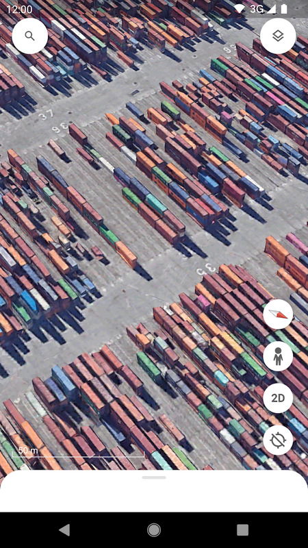
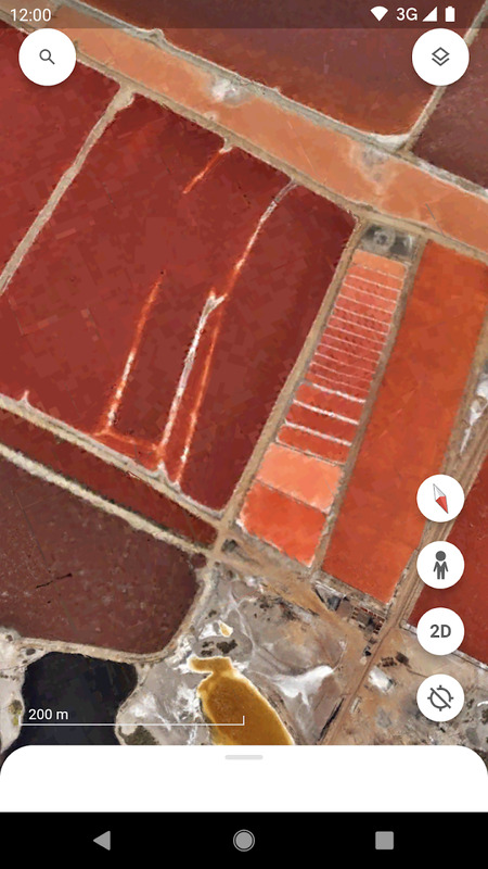
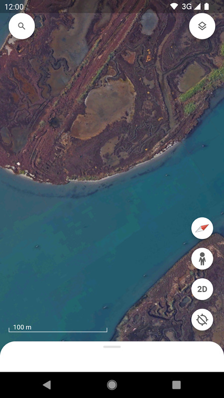
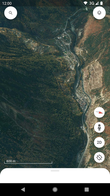
High-Resolution Satellite Imagery and Intuitive 3D Maps
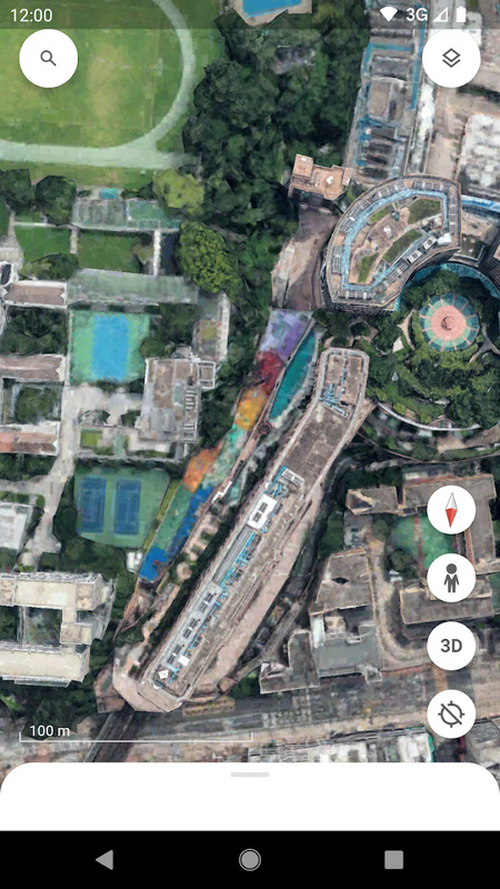
Google Earth APK offers stunning satellite imagery, crisp enough to recognize neighborhoods, roads, and even iconic buildings worldwide. Users experience a dynamic globe composed from these images, supported by the accurate geographic data that underpin GIS systems.- Images appear in lifelike detail, with major cities boasting 3D buildings and terrain features.
- Rotating the globe is smooth every swipe and pinch provides control over zoom and angle.
- High-resolution views make spotting geographic wonders simple, from pyramids to rainforests.
- Street View mode lets you “walk” along real streets in hundreds of cities, transforming your device into a virtual passport.
Navigation Assistance, Search, and Personalization
Google Earth APK assists users in more than just sightseeing. The app streamlines searching for locations and customizing your map experience.- Enter any address, location name, or even geographic coordinates. The app pinpoints places with remarkable accuracy, giving you direct access to nearly any spot on Earth.
- Navigation feels intuitive, and touch controls let you pan, tilt, or zoom with simple gestures.
- Create placemarks your digital pins for tracking favorite places or marking destinations for future visits.
- Customize routes, draw shapes, or add notes and photos to enrich your map.
- Easily save personalized maps to Google Drive, ensuring your discoveries remain organized and shareable.
Enrich Your Learning with Google Earth APK and Voyager Interactive Tools
Voyager – In-Depth Interactive Tours
Voyager within Google Earth represents an extraordinary blend of storytelling and discovery. It guides users through curated tours, each themed and packed with expert content.- Tours are crafted by scientists, historians, and Google partners subjects range from wildlife migration to natural wonders.
- Each Voyager story is interactive, featuring text pop-ups, embedded photos, and video explanations.
- For learners, these journeys offer an engaging and memorable way to absorb world geography, history, and science.
Explore Time, Space, and Nature
Google Earth doesn’t just anchor you in the present; it lets you travel through time and into space.- The Timelapse feature allows you to see landscapes, cities, and environments in transformation, year after year perfect for viewing the growth of urban areas or the shifting course of rivers.
- Switch modes to explore not only Earth, but also the Moon and Mars, with authentic images and 3D models provided by leading organizations like NASA, USGS, and Copernicus.
- Delve beneath the waves: View the ocean floor, reefs, and sunken ships, all mapped in vivid color.
Comparing Google Earth APK, Google Earth Pro, and the Mobile App Experience
Google Earth APK on Android: Strengths and Weaknesses
On Android, Google Earth APK provides mobility and flexibility unmatched by the desktop version. You can explore anywhere, any time whether you’re riding a bus or lounging at home. Here’s how its strengths and limitations compare:| Feature | Google Earth APK (Android) |
|---|---|
| ✓ Mobility | Use anywhere on your phone |
| ✓ Touch controls | Intuitive pinch, zoom, rotate |
| ✓ 3D cityscapes | Yes, in high detail |
| ✓ Street View | Seamless integration |
| ✓ Custom mapping tools | Mark, annotate, and share |
| ✗ Data size demand | High for 3D/HD images |
| ✗ Requires decent device | Best on modern smartphones |
| ✓ Frequent updates | Yes, for images and features |
- Android users receive frequent updates and expanded language support, including Vietnamese.
- Some ultra-high-resolution features may depend on hardware capability.
- In my use, even older devices run basic features well, but full 3D cityscapes shine brightest on recent phones.
Web and Pro Desktop Versions
While the mobile app thrives on accessibility, desktop and web versions provide power and scale. Google Earth can run directly in web browsers or via the advanced Google Earth Pro version for deeper geographic work.- Web version:
- No installation needed just launch in your browser and get nearly all the exploration features.
- Slight trade-off in touch control fluidity, but gains keyboard shortcuts and big-screen viewing.
- Perfect for classroom demonstrations or collaborative projects.
- Google Earth Pro:
- Advanced tools for importing/exporting GIS data, drawing polygons, and annotating at a professional level.
- Useful for deep research, urban planning, and educational or scientific projects.
- Supports importing GeoJSON files and other formats for enhanced customization.
| Version | Strengths | Considerations |
|---|---|---|
| Web | Instant access anywhere | Lacks full offline function |
| Pro | Powerful GIS, custom analyses | Best for specialists |
Real-Life Uses for Google Earth APK in Navigation, Education, and Travel Planning
Support for Planning, Education, and Entertainment
Google Earth APK integrates into daily life with actions as simple as planning a trip or exploring a famous site for fun.- Travelers preview destinations like Ha Long Bay or Dalat visualizing every detail before departing using Google Earth.
- Teachers can use the app to teach about rivers, cities, or climate with dynamic satellite imagery and Voyager tours.
- Students complete research assignments by observing real environments.
- Families plan road trips by dropping placemarks for stops and attractions.
- Sometimes, I’ll “visit” white sand beaches using Street View just to unwind mentally after a long day the experience brings relaxation close to home.
Dynamic Digital Experience and Personalized Tools
- Save favorite spots, create custom routes, and add personal photos to build your virtual “travel diary.”
- Share explorations with friends or classmates via Google Drive.
- Activate 3D mode in major cities to experience buildings at eye level it’s as close to a city stroll as you can get without leaving your room.
- Use measurement tools to calculate the distance from your home to Tokyo Tower or across the Sahara Desert; these calculations are straightforward and user-friendly.
Latest Google Earth APK Updates: Enhanced Satellite Imagery and Android Compatibility
Enhanced Imagery, Compatibility, and Personalization
Recent updates have focused on:- Improved 3D cityscapes urban zones now render faster and in greater detail.
- Enhanced compatibility for newer Android devices and better performance on lower-spec phones.
- Satellite imagery is refreshed regularly through partnerships with agencies like NASA, USGS, and Copernicus, ensuring the map stays current and captivating.
- Optimized Street View, better support for GeoJSON formats, and streamlined importing of images on maps.
- Multi-language choices, including Vietnamese, broaden access in many regions.
Remaining Limitations to Note
- Some remote or rural regions may still display basic or lower-resolution images.
- High-quality viewing especially Street View and 3D requires a relatively recent device for seamless operation.
- Large image downloads may consume plenty of mobile data, so connecting via Wi-Fi is a good practice if you plan to “travel” for hours.
Why Google Earth APK for Android Delivers Limitless Exploration and Discovery
Google Earth APK transforms Android devices into windows to the world, delivering satellite imagery, detailed 3D cityscapes, and virtual journeys in a compact, intuitive mobile app. Every session inspires new discoveries lakes you never heard of, towns you’d like to visit, even corners of the universe previously unimaginable. Students learn more vividly, travelers plan with greater precision, and dreamers find endless places to visit from their armchairs. Whether preparing for a real adventure or making a virtual trip, Google Earth APK stands out as a gateway to infinite exploration, education, and fun. There’s something magical about seeing your home, your country, or the pyramids from thousands of kilometers away then zooming in closer and closer. That sense of wonder never gets old. Grab your device, open the app, and let the journey begin no passport required. Download ApkLatest Android Releases
Best APK Games
Top APK Apps
